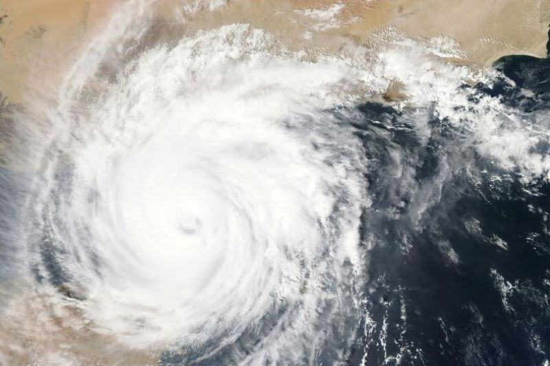
 Cyclone Remal
West Bengal, Odisha brace for impact of Cyclone Remal, check the latest update on landfall time
Cyclone Remal is likely to intensify into a Severe Cyclonic Storm and cross Bangladesh and adjoining West Bengal coasts between Sagar Island and Khepupara by May 26 midnight.
" Yesterday's Depression over central Bay of Bengal intensified into a Deep Depression and lay centred at 0530 hrs IST of 25th May, 2024 over Eastcentral Bay of Bengal. The Deep Depression over Eastcentral Bay of Bengal moved nearly northwards with a speed of 17 kmph during past 06 hours and lay centred at 0830 hrs IST of 25th May, 2024 over the same region near latitude 18.0°N and longitude 89.7°E, about 440 km southsouthwest of Khepupara (Bangladesh), 440 km south-southeast of Sagar Islands (West Bengal) and 480 km south-southeast of Canning (West Bengal). It is very likely to continue to move nearly northwards and intensify into a Cyclonic Storm over Eastcentral & adjoining north Bay of Bengal around 25th May evening," read the statement issued by the India Meteorological Department (IMD). I
Heavy Rainfall Warning
West Bengal: Light to moderate rainfall at most places with heavy to very heavy rainfall at a few places is likely over coastal districts of West Bengal and eastern districts of Gangetic West Bengal adjacent to Bangladesh on 26th & 27th with isolated extremely heavy rainfall over these districts on 26th May.
Light to moderate rainfall at most places with heavy to very heavy rainfall at isolated places likely over eastern districts of Sub-Himalayan West Bengal on 27th and 28th May.
Odisha: Light to moderate rainfall at most places with isolated heavy rainfall likely over North Coastal Odisha on 25th & 26th May.
Northeastern States: Light to moderate rainfall at most places with heavy to very heavy rainfall at isolated places is likely over Mizoram, Tripura and South Manipur on 26 th and over Assam, Meghalaya, Arunachal Pradesh, Nagaland, Mizoram, Manipur & Tripura on 27 th & 28th May.
Isolated extremely heavy rainfall is also likely over Assam, Meghalaya on 27th & 28th May, Arunachal Pradesh on 28th May and Mizoram & Tripura on 27th May.
Andaman Islands: Light to moderate rainfall at most places with heavy rainfall at isolated places over north Andaman Islands on 25th May.
Met office said squally wind speed reaching 40-50 kmph gusting to 60 kmph is likely to be experienced along and off Bangladesh and WestBengal and adjoining North Odisha coasts from May 25.
It is likely to increase becoming gale windspeed reaching 60-70 kmph gusting to 80 kmph from morning of May 26 and 100-120 kmph gustingto 135 kmph along and off Bangladesh and adjoining West Bengal coasts from evening of 26th May forsubsequent 12 hours.
Support Our Journalism
We cannot do without you.. your contribution supports unbiased journalism
IBNS is not driven by any ism- not wokeism, not racism, not skewed secularism, not hyper right-wing or left liberal ideals, nor by any hardline religious beliefs or hyper nationalism. We want to serve you good old objective news, as they are. We do not judge or preach. We let people decide for themselves. We only try to present factual and well-sourced news.


