


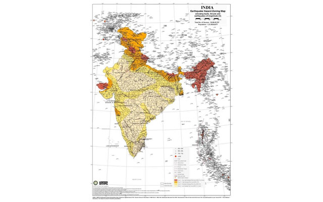
User friendly Earthquake Hazard Zoning Maps with Tehsil level details released
These maps were released hereon Monday by the Minister of Housing & Urban Poverty Alleviation M.Venkaiah Naidu.
The colour coded maps easily convey location in five different Zones of earthquake intensity which helps in planning for disaster resistant construction with necessary technical assistance.
BMPTC of the Ministry of HUPA has prepared these maps at the behest of NDMA.
Appreciating the joint effort of NDMA and BMPTC, Shri Naidu urged both the agencies to ensure digitization of these maps at the earliest so that they could be used by the public.
He also suggested evolving Mobile App based on these maps.
He said that the maps would be of significant help to architects, engineers, land use planners, insurance agencies and those involved in disaster mitigation and emergency planning and management.
Sailesh Agarwal, Executive Director of BMPTC said on the occasion that out of the 304 million households in the country, about 95% are vulnerable to earthquakes in different degree.
BMPTC prepared the maps using the data available with the Survey of India, Geological Survey of India, Meteorological Department and Census of India.
Image:BMTPC
Support Our Journalism
We cannot do without you.. your contribution supports unbiased journalism
IBNS is not driven by any ism- not wokeism, not racism, not skewed secularism, not hyper right-wing or left liberal ideals, nor by any hardline religious beliefs or hyper nationalism. We want to serve you good old objective news, as they are. We do not judge or preach. We let people decide for themselves. We only try to present factual and well-sourced news.
Support objective journalism for a small contribution.


