


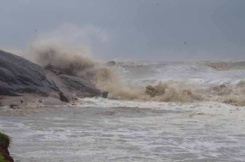
 Cyclone Yaas
Low-pressure area in Bay of Bengal may concentrate into deep depression: IMD
New Delhi/UNI: The Indian Meteorological Department (IMD) on Saturday said that a low-pressure area has been formed over east-central Bay of Bengal at around 0830 hrs and is very likely to concentrate into a depression by May 23 morning.
“It is very likely move north-northwestwards, intensify into a ‘Cyclonic Storm’ by May 24 and further into a ‘Very Severe Cyclonic Storm’ during the subsequent 24 hours. It would continue to move north-northwestwards, intensify further and reach North Bay of Bengal near West Bengal and adjoining north Odisha and Bangladesh coasts around May 26 morning and subsequently will cross West Bengal and adjoining north Odisha and Bangladesh coasts around evening on the same day,” the IMD said in a weather bulletin.
The national weather department also said that because of this system, Andaman & Nicobar Islands will witness light to moderate rainfall at most places with heavy to very heavy falls at isolated places on May 22-23 and May 25-26.
Similarly, West Bengal and Sikkim will have light to moderate rainfall at most places with heavy to very heavy falls at isolated places very likely on May 26 and heavy to very heavy rainfall at a few places and extremely heavy falls at isolated places on May 27.
Light to moderate rainfall at many places with heavy falls at isolated places very likely over north coastal Odisha on May 25 and over north Odisha on May 26.
Squally wind speed reaching 40-50 kmph gusting 60 kmph is very likely to prevail over North Bay of Bengal and along and off Odisha – West Bengal – Bangladesh coasts from 24th evening and would increase gradually becoming 50-60 kmph gusting to 70 kmph from 25th evening. It would further increase becoming gale wind speed 60-70 kmph gusting to 80 kmph from May 26.
Sea condition will be very rough with high tidal waves and the fishermen are advised not to venture into southeast & east central Bay of Bengal, Andaman Sea and along and off Andaman & Nicobar Islands during May 22– 26 and those who are out in the Deep Sea of eastcentral & adjoining northeast Bay of Bengal are advised to return to the coast.
Support Our Journalism
We cannot do without you.. your contribution supports unbiased journalism
IBNS is not driven by any ism- not wokeism, not racism, not skewed secularism, not hyper right-wing or left liberal ideals, nor by any hardline religious beliefs or hyper nationalism. We want to serve you good old objective news, as they are. We do not judge or preach. We let people decide for themselves. We only try to present factual and well-sourced news.
Support objective journalism for a small contribution.


