


'Nilofar' intensifies into "very severe cyclone"
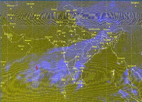
"The very severe cyclonic storm, ‘NILOFAR’ over westcentral Arabian Sea remained practically stationary, and lay centred at 1430 hours IST of 27 th October, 2014 near latitude 14.9 0 N and longitude 62.0 0 E, about 1170 km southwest of Naliya (Gujarat), 1230 km south-southwest of Karachi (Pakistan) and 880 km east-southeast of Salalah (Oman)," the IMD said in a statement.
"It would move initially north-northwestwards during next 24 hrs and then recurve northeastwards and cross north Gujarat and adjoining Pakistan coast around Naliya by 31st October morning. However, as the system would come closer to Gujarat coast, it would weaken and cross the coast as a severe cyclonic storm," the statement said.
The intensity of the cyclone would increase gradually with heavy to very heavy rain fall at a few places from Oct 30 night.
"Squally winds speed reaching 45-55 kmph gusting to 65 kmph would commence along and off Gujarat coast from 30th October morning and would become 100-110 kmph gusting to 125 kmph at the time of landfall. Sea condition along and off Gujarat coast will be rough to very rough from 30th October morning and would become very high from afternoon of 30th October," the IMD said.
The cyclone is expected to bring extensive damage to thatched roofs and huts. Minor damage to power and communication lines are likely to happen due to uprooting of large avenue trees.
The IMD has suggested that fishermen out at sea along and off Gujarat coast should return to the coast, with total suspension of fishing operations.
"Coastal hutment dwellers to be moved to safer places. People in affected areas to remain indoors around landfall time," the Met department said.
Support Our Journalism
We cannot do without you.. your contribution supports unbiased journalism
IBNS is not driven by any ism- not wokeism, not racism, not skewed secularism, not hyper right-wing or left liberal ideals, nor by any hardline religious beliefs or hyper nationalism. We want to serve you good old objective news, as they are. We do not judge or preach. We let people decide for themselves. We only try to present factual and well-sourced news.
Support objective journalism for a small contribution.


