


 Kaziranga
Study shows grassland and agricultural land will increase in Kaziranga by 2050
Golaghat: A recent study has predicted that water bodies, sand or dry river beds, and forests will decrease in Kaziranga while the area covered by grasslands and agricultural land will increase by 2050.
A study “Land Use and Land Cover Change Monitoring and Prediction of a UNESCO World Heritage Site: Kaziranga Eco-Sensitive Zone Using Cellular Automata-Markov Model” carried out by researchers from the Geography Department of Gauhati University in collaboration with different institutions has attempted to analyse the land use land cover (LULC) change in the Kaziranga Eco-Sensitive Zone using remote sensing data, reports East Mojo.
Satellite remote sensing and the geographic information system (GIS) are widely used for monitoring, mapping, and change detection of LULC change dynamics.
“Between 1990 and 2020, waterbodies, grassland, and agricultural land decreased by 18.4, 9.96, and 64.88%, respectively, while sand or dry river beds, forest, and built-up areas increased by 103.72, 6.96, and 89.03%, respectively. The result shows that the area covered with water bodies, grassland, and agricultural land is mostly converted into built-up areas and sand or dry river bed areas. According to this study, by 2050, water bodies, sand or dry river beds, and forests will decrease by 3.67, 3.91, and 7.11%, respectively; while grassland and agriculture will increase by up to 16.67% and 0.37%, respectively” the study says as quoted by East Mojo.
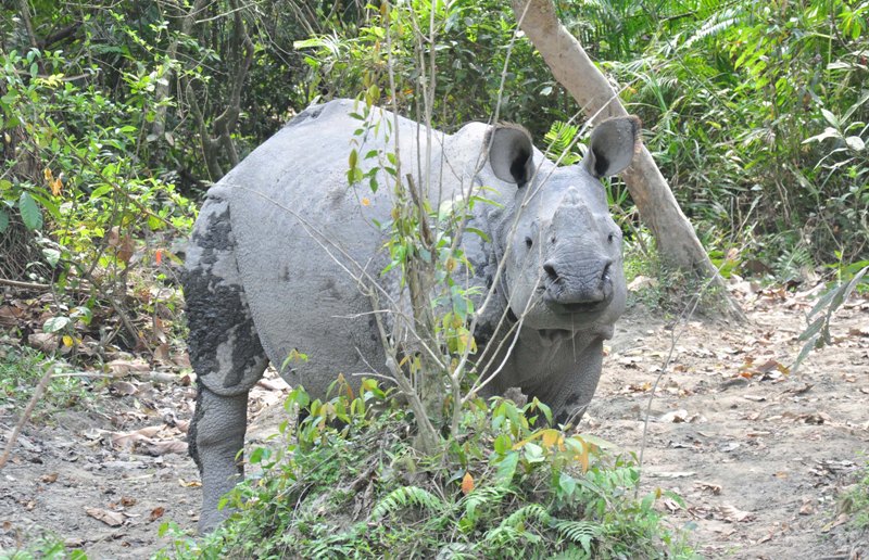
“The study area is one of the famous national parks in India, and biologically, it has a lot of significance. Kaziranga is regarded as one of the oldest wildlife refuges in the world. The park’s contribution in saving the Indian one-horned rhinoceros from the brink of extinction at the turn of the 20th century to harbouring the single largest population of this species is a spectacular conservation achievement. Therefore, LULC change in this national park is a burning issue concerning conservation” the study mentioned.
Kaziranga National Park is a national park in the Golaghat and Nagaon districts of the state of Assam, India.
The park, which hosts two-thirds of the world's great one-horned rhinoceroses, is a World Heritage Site.
Support Our Journalism
We cannot do without you.. your contribution supports unbiased journalism
IBNS is not driven by any ism- not wokeism, not racism, not skewed secularism, not hyper right-wing or left liberal ideals, nor by any hardline religious beliefs or hyper nationalism. We want to serve you good old objective news, as they are. We do not judge or preach. We let people decide for themselves. We only try to present factual and well-sourced news.
Support objective journalism for a small contribution.


